247-Kilometer Smart Road Corridor to Ankara

A new threshold is being crossed on Turkiye's smart road map: Following the roughly 40-kilometer test corridor in Istanbul, it is now Ankara's turn. According to a statement by Minister of Transport and Infrastructure Abdulkadir Uraloglu dated November 8, 2026, project work is underway for a 247-kilometer Intelligent Transportation Systems (ITS) corridor in the capital that will enable vehicles to communicate with the roads. So where exactly does this corridor run, what technologies does it include, and what will it offer drivers?
The Corridor's Route: The Ring Motorway, Golbasi and Polatli
The Ankara corridor is not built on a single road; it consists of the combination of three sections. At the center of the plan is the 166-kilometer Ankara Ring Motorway. To this are added the 22-kilometer Golbasi-Ogulbey section and the 59-kilometer Polatli segment. In total, a 247-kilometer line emerges extending along the Polatli-Golbasi-Ankara Ring Road route.
The figure alone may remain abstract; a comparison makes it clear. The first implementation in Istanbul was about 40 kilometers. The Ankara project covers a route more than six times that length. This is read as a signal that vehicle-road communication in Turkiye is moving from pilot scale to a genuine regional transportation infrastructure.
Highlights
- Project work is underway for a 247 km smart transportation corridor in Ankara
- Route: 166 km Ring Motorway, 22 km Golbasi-Ogulbey, 59 km Polatli section
- The project is planned with 5G support; Cooperative Intelligent Transportation Systems (C-ITS) is included in the second phase
- The first implementation was carried out on the Istanbul Hasdal-Airport line as approximately 40 km
- An exact completion date has not yet been announced
The Road That Talks to Vehicles: What Is V2X and How Will It Work in This Corridor?
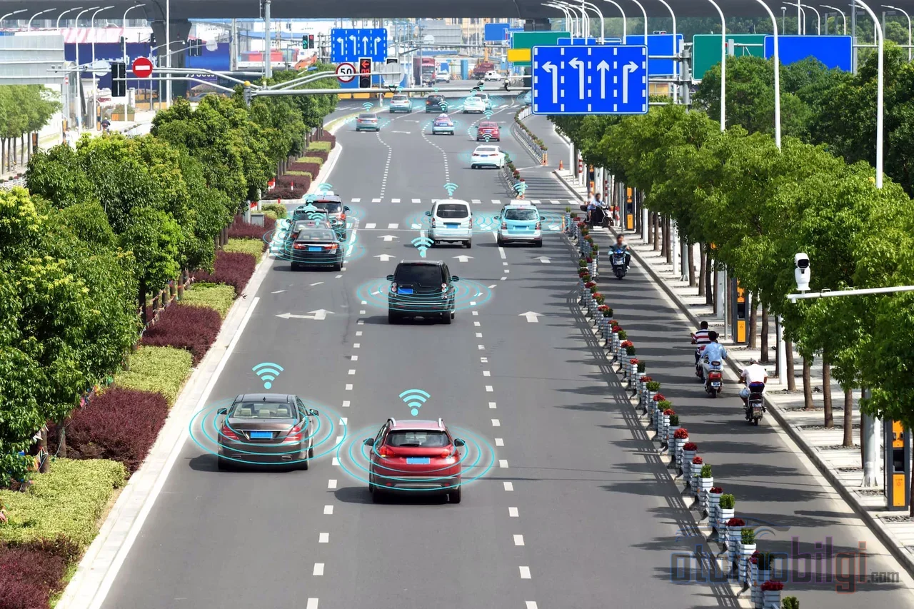
The technological backbone of the project is the communication structure that enables vehicles to exchange data with roadside units and control centers. This approach is based on an architecture known in the industry as vehicle-infrastructure and vehicle-center communication; referred to broadly as V2X. To put it briefly: the road can transmit information about road and traffic conditions to the vehicle traveling on it; the vehicle, in turn, receives this data and contributes to producing decisions that serve informing the driver and increasing traffic safety.
The Ankara corridor will be built on this structure with 5G support. The goal is to test and implement connected and autonomous vehicle technologies over a wider area. The project is evaluated within the scope of the second phase of Cooperative Intelligent Transportation Systems (C-ITS) efforts.
Built on Top of the Existing Digital Infrastructure
The corridor is not being built in an empty field. The digital layer already operational on the highways forms the backbone of the project:
- Signaling systems and variable message traffic signs
- Meteorological information stations
- Camera and monitoring systems
- Vehicle and incident detection systems
- Electronic toll collection systems
- Tunnel control systems
Road and traffic conditions are already monitored in real time via the Main Intelligent Transportation Systems Center in Ankara and regional centers. The new corridor aims to build the link between monitoring and intervention by adding vehicle-infrastructure communication on top of these centers.
Istanbul Was the Preliminary Stage: Lessons from the First Corridor
Turkiye's first K-AUS Test and Application Corridor was implemented on a section of approximately 40 kilometers along the Hasdal-Istanbul Airport route; 5G-supported intelligent transportation technologies are being tested on this line. According to Minister Uraloglu, the corridor in Istanbul forms an important infrastructure for the project planned in Ankara; the knowledge and experience gained from the first application will be used in carrying connected and autonomous driving technologies to a wider route in Ankara.
The meaning of this sequencing is clear: Turkiye is not moving this technology to a nationwide scale in a single step. First the system is matured on a narrow route, then the scale is expanded. It should also be noted that the Istanbul line is still in the testing stage; this is an indication that the process is still at its beginning.
Expected Contribution to Drivers and Traffic Safety
The Ministry positions intelligent transportation systems among technologies that increase traffic safety, travel comfort and transportation efficiency. With the strengthening of the digital infrastructure, the goal is to make traffic management more effective; the technologies have a wide range of uses, from informing the driver to increasing safety.
From the driver's perspective, the promise is concrete: faster and more accurate information about hazards, congestion and road conditions with data coming from roadside units and control centers. In the long term, this infrastructure will serve as a real field laboratory for the development of connected and autonomous driving technologies in Turkiye.
Timeline and Unknowns
As of November 8, 2026, the statement in the official announcement is clear: project works are ongoing. No exact completion or opening date was shared; cost and tender details have not yet been disclosed either. Considering that the Istanbul corridor is still in the testing stage, it would be no surprise if the Ankara line takes more than a year to enter service.
Nevertheless, the overall picture is meaningful. A road that started with a 40-kilometer test line has evolved into a plan for a 247-kilometer corridor. A transportation network where vehicles and roads communicate with each other is no longer an idea on the drawing board in Turkiye; it has turned into an investment with a defined route, defined technology and an announced phase. The coming period will show whether this plan will be tied to a calendar.